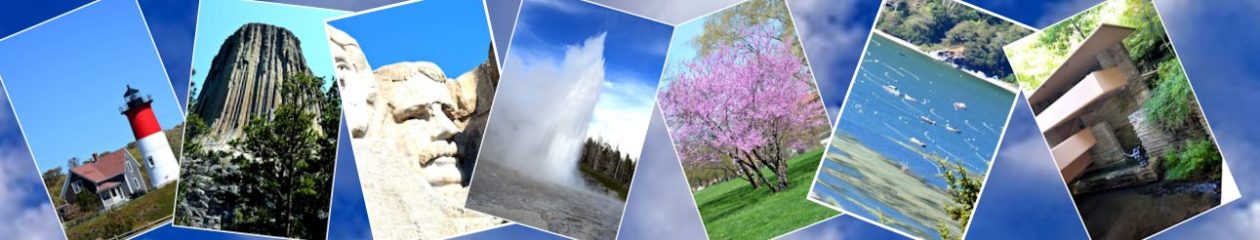
For the second year we are spending the winter in Yuma AZ. We have a membership in a Campground “timeshare” so it’s inexpensive and we really like the RV Park.
Even though its in the middle of the desert, there’s a lake at the park. Here’s a picture:
Cascade Caverns is just a few miles from the Cave without a Name. It’s also privately owned and operated. The Cascade Caverns is at the low point in a series of rolling hills, so every time it rains hard the caverns flood. We visited a few years ago but couldn’t visit the Cascade Caverns because it had been raining and was flooded.
The owners built a dam and some retaining walls around the entrance to try and minimize the flooding, but water gets in from other cracks and openings.
The Cascade Caverns are similar in size and types of formations to the Cave without a Name. One unique feature, however, is that at the lowest point on the tour there is a pond with a sinkhole to a lower cavern that is mostly underwater. There is a tour down into the lower cavern but we didn’t take it (would have freaked me out totally with my claustrophobia and fear of water).
It was discovered when a farmer’s cow disappeared. People were helping to look for it and they found the poor thing about 30 feet down a big hole. The cow was killed by the fall. But, they discovered the caverns at that time and the owner started exploring it.
There is a primitive campground on the property and while on the tour the guide explained that the campground was actually right above the part of the cavern we were standing in!
Here are some pictures:
Looking up at a bridge from the cavern entrance
Soda straws forming
Stairs leading down into the cavern
The green is bacteria from all the water flowing through the cavern
There is a hole at the end of the ladder leading to another cavern
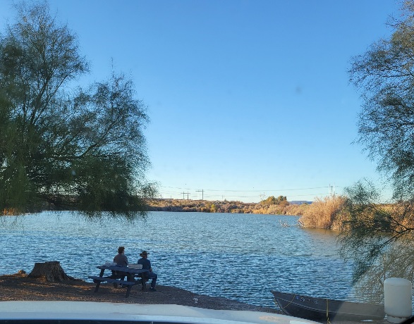
The Cave without a Name is a natural limestone solutional cave in central Texas. It is about 60 feet below the surface and has numerous formations. It has several fairly large rooms as well as narrow passages. There was one passage of about 20 feet where you have to bend at the waist, but it was wide so I didn’t get too claustrophobic.
The cave is privately owned and operated. When it was first discovered and opened to the public the owner didn’t know what to call it, so it was called Cave without a Name for several years. Then the owner held a contest to give it a name and offered what was a large reward in that time (about the 1920s). He renamed it but the local people and a lot of tourists thought it was a new cave and were not happy to find it was the same cave they had previously visited. So, the owner put the original name back.
While in eastern TN we found that there was a nearby cave to explore. We both planned to go through it but the first thing the guide did was talk about the section that was about 200 feet long, between 5 and 20 feet high and barely wide enough to hold your elbows out by your side. That was it for me! With some mild claustrophobia I didn’t think I could manage that. For a few feet maybe, but 200 feet! NOPE! So I waited in the truck and Jeff toured it without me.
He said afterwards that there were just a few short places that I would have a problem with but it was too late at that point. Oh well!
This cave had lots of formations and they used colored lighting to highlight them. There was a large group and the guide said to only take pictures when the group stopped so Jeff didn’t get as many pics as he sometimes gets. But it looks interesting!
While in eastern TN we drove up into the Smoky Mountains. To get their from Sevierville you drive through Pigeon Forge which appears to be one long amusement center. Several museums like Ripleys, Titanic, and a Wax Museum. Several water and bumper car parks as well as tons of motels and restaurants.
Past that it gets much prettier. We went up to about 5,000 ft and then down a bit to Cherokee, NC. From there we turned north to come back a different route.
We didn’t take too many pictures as a lot of the road is narrow and you have to find viewpoints to get off the road.
We stayed for a week in Clarksville, TN and while there we found that there is a cavern right in town! So we decided to visit it.
This cavern system was used for over 1,000 years by native Americans and they did some rock painting. It is thought that the cavern was used for warrior initiation, where a warrior had to go in a certain distance, probably more than a mile. Some places were very tight and required crawling on bellies. Some of the symbols seem to represent a warrior on his side with a headdress on. Some seem to indicate the sun and moon. The cavern is still visited by native Americans elders who bring young tribe members to connect with their heritage. Because this cavern is still used by native Americans and is considered sacred there is no photography allowed inside and the tour is by flashlight (bring your own or buy one) so they can control the lighting to avoid further degradation of the ancient pictographs.
The cavern was discovered by white men before the Civil War and extensive digging during the war was done to expand parts of the cave to use for storage and for soldiers to rest and hide.
From the Civil War to the 1960s the cavern was owned by various people and visitors were encouraged to break off a piece of stalactite for a souvenior and to write on the walls. Lots of graffiti!
A country singer Roy Acuff, owned it for about 20 years in the 60s and 70s and held concerts at the opening which was enlarged and paved to be an ampitheatre.
The tour had a couple of spots where we all had to stoop over to get through, which made me nervous but I did ok. Unfortunately at one point where there was a slope and it was muddy I slipped and fell onto my left hip. Didn’t really hurt me and surprise! my right hip which had been hurting me for a few weeks stopped hurting! I had seen a chiropractor twice in the past couple of weeks but it didn’t seem to help. After a few days the pain in my right hip came back but one more trip to a chiropractor seemed to fix that, no more pain – so far.
One large room had weird shapes showing in the roof, I thought they were fish fossils. Turns out I was right but 10m years old!
It was very cool and humid inside the cave (around 56 degrees) and when we came out of the cave into the ampitheater where it was quite warm and very humid everyone’s glasses fogged up, so we all spent a few minutes cleaning our glasses so we could see again.
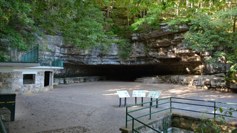
No pictures though! Not even any on the website from inside the cavern. Here’s a picture of the ampitheater:
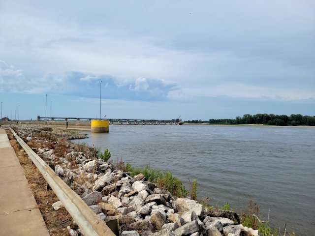
Clarksville MO is a very small town that has mostly dried up. It has 372 people (as of 2020). A lot of buildings along the main roads are empty and have been for decades. Apparently when a nearby cement plant shut down, the town couldn’t recover.
The town is right on the bank of the miss river. There is a dam on the river with a lock for boats. Look that up.
Right in town is a steep hill that is the highest point right alongside the Mississippi. Until about the 1940s there was a “sky trolley” from downtown to the summit of that hill. There were some little houses and a view point on the summit. The equipment is still along the road but it had to close for the too high insurance costs the town could not afford. We tried to find a road up to the summit but it was impassable.
There is one place to eat in Clarksville – Cherry bar and grill. Good food! I was surprised to see people smoking in there.
There are no gas stations, no grocery stores or even convenience stores. One business is in operation that makes candles and stationary for hotels. It is currently run out of abandoned buildings along the main road and the company is building a new building to house the operation. I heard this from an old gentleman who was walking his dog nearby.
The nearest town with facilities is Louisiana MO, about 10 miles away.
Our RV park is about 4 miles inland from Clarksville, surrounded by corn and soybean fields.
I took a few pics of the river and dam and found a postcard picture showing the Sky Trolley and the dam from the 1940s. Here they are:
Postcard view of the Dam from the Sky Trolley circa 1940s
Dam on Mississippi River at Clarksville
Looking south along the Mississippi River from the Riverfront Park in Clarksville
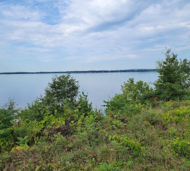
We visited Chippewa Falls, WI for a week and while there we drove to a nearby lake, Lake Wissota. It’s very beautiful! There’s a very large state park along the shore with lots of campsites and day use areas. We got a picture of the lake from the shore, I don’t feel it does justice to the beauty of the area.
There’s also a lot of corn and soybean fields throughout this area. We also saw some sunflower fields and I snapped a picture of one of them.
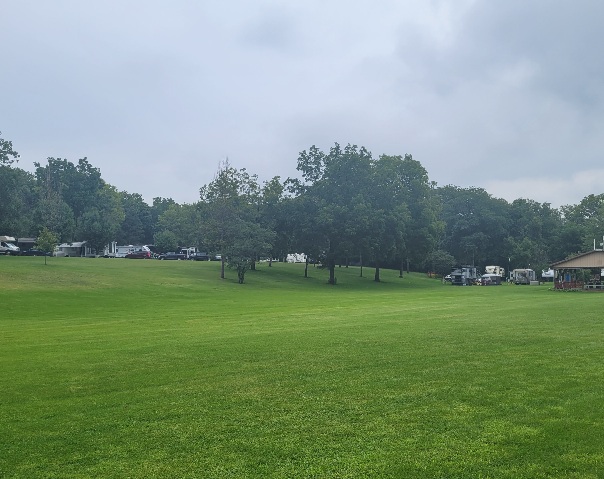
We stayed in Rockford IL which is the home of the real Rockford Peaches, the women’s baseball team from WWII era..
The RV P all we stayed at is the Blackhawk Valley Campground. It’s huge with large sites and lots of green open area. It’s also right on the Kishaaukee River, several seasonal sites are along the river and there’s a small beach.
Here is a picture of the view from our front door:
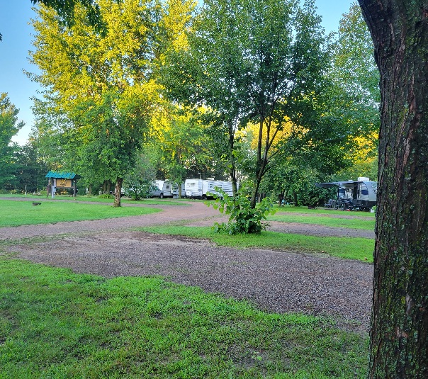
We are staying at a lovely little RV Park behind a small motel in Chippewa Falls. It’s surrounded by corn fields and only has 20 sites. But it is very pretty! It’s secluded, has large sites and is just a few miles away from the city as well as a lake and all surrounded by corn and soy bean crops.