Chaco Canyon is a complex of several great houses build and used by the Puebloan people between about 850-1150A.D. The great houses were really cities – Pueblo Bonito is the largest and has 600 rooms built in 4 stories. Many were storage rooms and public rooms. Peublo Bonito housed perhaps 2,000 people but the population swelled during feast and ceremonial times when people would come from the other great houses and even from further away, swelling the population to perhaps 6,000 people.
Several of the rooms are round and built down in the ground on the lowest level in large courtyards. They are kivas and they were used for several different ceremonial purposes.
The Puebloan people who are descendents of the people who lived in the great houses have many stories about how their ancestors lived. They believe that the great houses were abandoned at about 1150A.D. simply because the people were nomadic and left it was time to move on. The food supplies may have become scarce after so long in one place, or there may have been a drought. It’s unknown.
All of the great houses were heavily looted in the late 1800s by settlers, many of whom took away wagons of the squared stones to use in their own houses. A surveyor in the 1880s took pictures of the Pueblo Bonito showing it as much larger and more complete at that time. Sand and dirt filled in a lot of it and the National Geographic Society had a project to remove much of the dirt and uncover a lot of Pueblo Bonito so that visitors can see a lot of the ruins. Several other great houses are still mostly under heavy layers of sand and dirt.
The several great houses in the area were connected by roads that were very straight…when the road came to a cliff a stairway was built right into the cliff to preserve the straightness of the road. There’s a nearby very tall and steep butte, Fajada Butte, that has carvings at the top showing the progression of the moon and stars. So it’s known that the Puebloan people charted and studied the night sky.
Here are pictures that we took at Chaco Canyon:
section of wall showing height
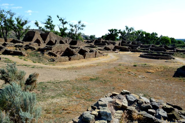
ruins at Pueblo Bonita – largest great house
round rooms built into ground are ceremonial kivas
kiva showing bench around wall and pits for fire and support beams
How Pueblo Bonito may have looked at its peak
wall showing square window and large timber
wall showing architecture and remains of timbers
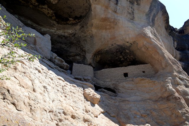
wall ruins against the cliff
tall walls – 4 stories high
section of wall with doorway and timber remains that were floorboards
stairs carved into cliff are part of road to another great house